When we decided to travel to South America a friend told us about his trip to the continent more than ten years ago. He went to a remote island, further south than Ushuaia where he did a multi-day hike: the Dientes Circuit on Isla Navarino. Kevin was immediately hooked and so the Isla Navarino became the starting point of our hiking adventures in Patagonia.
The main settlement on the island is Puerto Williams. It is the most southern town in the world and lies just across from Ushuaia in the Beagle Channel. There are two options to reach the island: by plane from either Ushuaia or Punta Arenas, or by boat. We opted for a 33 hour ferry trip from Punta Arenas to Puerto Williams promising views over the Magellan islands, glaciers and opportunities to spot dolphins, sea lions and whales.
We followed the advice of some fellow travelers who had just come back from the island and started our hike on a route east of the Dientes Circuit, heading straight south from Puerto Williams to Lago Windhond. Our plan was to spend a day at the lake and then join the Dientes Circuit to follow it clockwise. In total, we had foreseen seven days of walking.
Day 1: Starting the trek to Lago Windhond
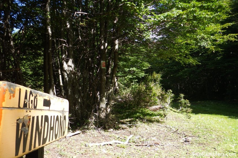
After a short night at Hostal Dientes de Navarino (the ferry had arrived in Puerto Williams at 1 am) and checking in with the local police to inform them of our itinerary we set off for our long awaited adventure. We left Puerto Williams to the east, through Villa Ukika and followed a dirt road on the search for the start of the hike. After a bit of walking we found a sign marking the way to Lago Windhond.
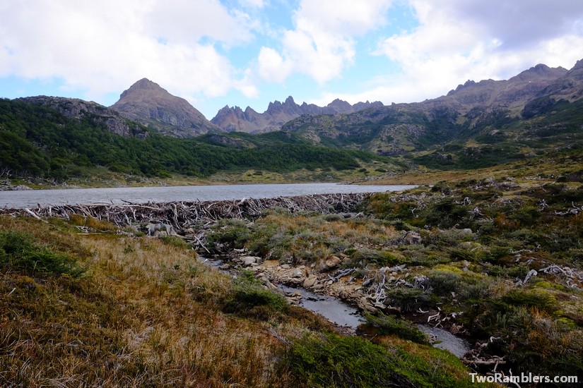
Immediately we were taken into the woods, on a well signed and maintained path. This promised to be a lot easier than our trek towards Cabo Froward. We met a couple walking in the other direction on a day hike. They warned us that it would not continue to be that easy. And indeed, we had not walked for five minutes since meeting them when we lost the path. We found ourselves on a big plain with a lake, created by a beaver dam. Around the lake the ground was wet and muddy, branches and trunks blocking the way. The following days we would pass a lot more of these lakes.
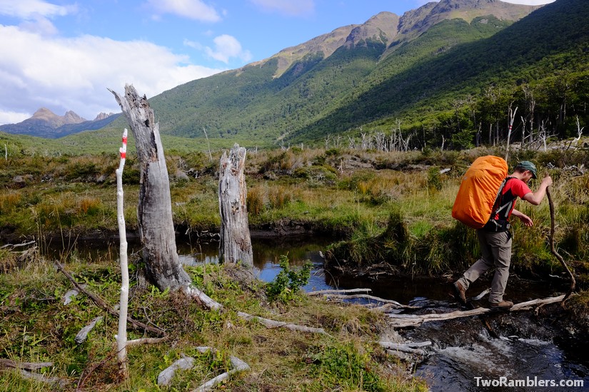
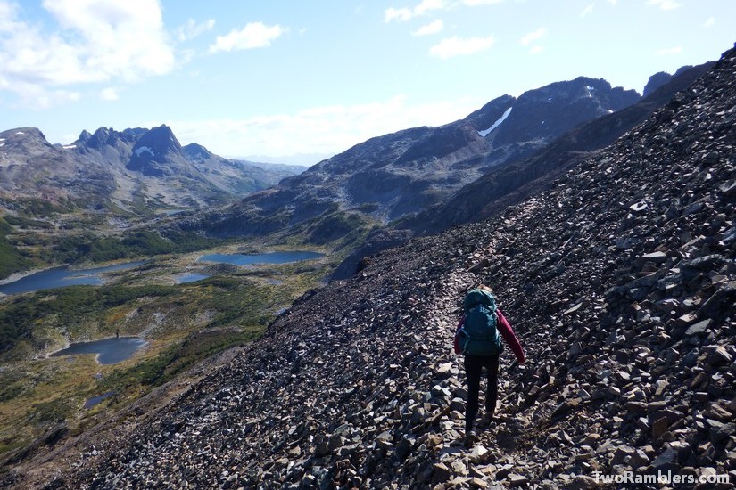
We enjoyed this first day of our hike. Landscapes changed between forests and open plains. We had to cross a few streams and climbed up next to waterfalls. To our right, we could see the pointy peaks of the Dientes de Navarino. The fainting red-white waymarks became rarer, to finally completely disappear and be replaced by pink ribbons. It was difficult to follow the exact path, the track was rather unmaintained. So we stuck to heading south in the direction of Lago Windhond whenever we had any doubts and always found the path again.
We put up our tent on a slope that provided an acceptable flat piece of grass, surrounded by some bushes for wind protection. Next to us was a little stream, joining one of the big beaver lakes that had created a beautiful waterfall. We cooked our dinner and Kevin spotted some beavers splashing their tails at each other as the sun set. It had been a perfect first day, we felt like we had found what we had been looking for.
Day 2: Reaching Refugio Charles
At the end of the second day we wanted to reach Lago Windhond, so after a good night’s sleep we set off. Kevin was still enthused about his night time bathroom visit. The sky had been clear: the Milky Way divided the sky in two and the full moon allowed for a good view over the beaver lake in black and white.
Our path went up for a good kilometer towards the highest point of the route to Lago Windhond at 500m. We met a Brazilian couple who had spent some time at the lake and told us about their fishing successes. Already a few people had told us that Lago Windhond was a great spot for fishing and we were looking forward to trying our luck.
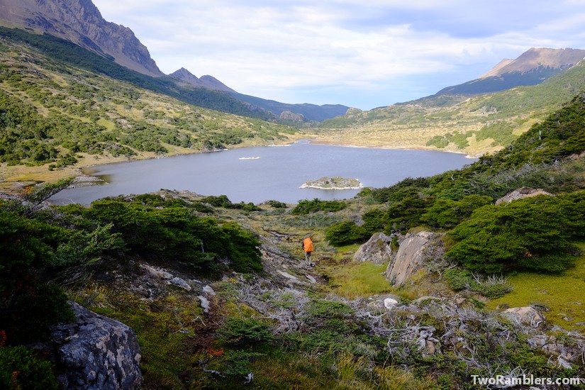
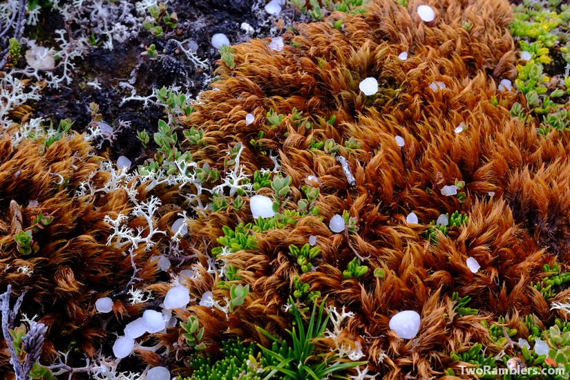
With this in mind we continued our route. The path became again more difficult because of fallen trees and the absence of waymarks. We lost quite some time at a collapsed refuge (Refugio Beaucheff), unsure if and where to cross the river next to it. Finally, Lago Windhond came into view and we left the forests behind us to cross an open plain. These last kilometres to the refuge at the lake felt like ages. Suddenly it started to hail and although completely flat the route was difficult over the swampy ground.
We reached the Refugio Charles together with an Australian couple Alex and Nitya, and Kyle from the US. They had taken the route along the Dientes Circuit. The refuge looked rather unstable and draughty, so we preferred to put up our tents. But it did have a good stove and the promised fishing material. We were all set to try our fishing luck the next day.
Day 3: At Lago Windhond
After a slow morning, doing some laundry, reading the refuge’s guestbook we headed to the lake to try fishing. Before he left on a day trip towards the Windhond Bay on the southern coast of Isla Navarino with Alex and Nitya, Kyle helped us getting a line ready with the things we had found in the refuge. Some fishing line on a spindle and a hook with a spoon (a metal piece reflecting in the water, resembling a small fish) was all we needed. With some tips from the refuge’s guestbook we hoped to have some fish for dinner.
We decided to try our luck along the eastern shore of the lake with some sandy beaches. According to the guestbook previous visitors had had a lot of success there. After preparing a fire place for once we would get out of the cold water, Kevin gave it a first try. He walked for about 100m until he was waist deep in the water and started lassoing the hook to throw it as far as possible to then pull it back in. With a lot of wind it was difficult to ensure that the wire did not entangle. Franziska came for help and quickly we developed a good technique and rhythm, Franziska managing the wire and Kevin throwing and pulling the line back in.
After an hour in the cold water without success we decided to take a break. While we warmed up at our fire, a French couple came along. They had come to Isla Navarino especially for fly-fishing. From them we learned that our chances would be higher in the morning or evening and with calmer weather.
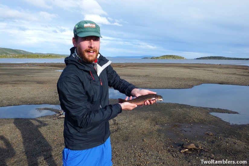
Back at the refuge, waiting for the evening for another attempt we met Dusty. Together with him we gave it another go. We chose a spot towards the mouth of a river meeting Lago Windhond and deployed our previously trained technique. After ten minutes we had our first catch: a salmon of about 25cm. How exciting! With the help of Dusty we managed to kill and clean the fish and headed straight back into the water. Another ten minutes and the next salmon was hanging on our hook.
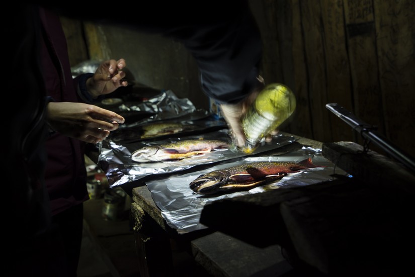
In the end of the day, after three hours of fishing we went back to the refuge with four salmons and a trout, all caught with our amateur hand line. Using some olive oil, herbs, garlic and tin foil from the refuge we prepared the fish ‘en papillote’ on the hot stove. They were delicious!
Day 4: From Lago Windhond to the Dientes Circuit
After the relaxing and successful day before, we understood how people end up ditching their trekking ambitions and spend their days instead at this magical spot exploring the surroundings and living from the fish in the lake. Someone had called it the “Into-the-wild-effect” in the refuge’s guestbook. Kevin was very tempted to stay some more days but we also wanted to have a look at the Dientes Circuit, so on Day 4 we left the refuge.
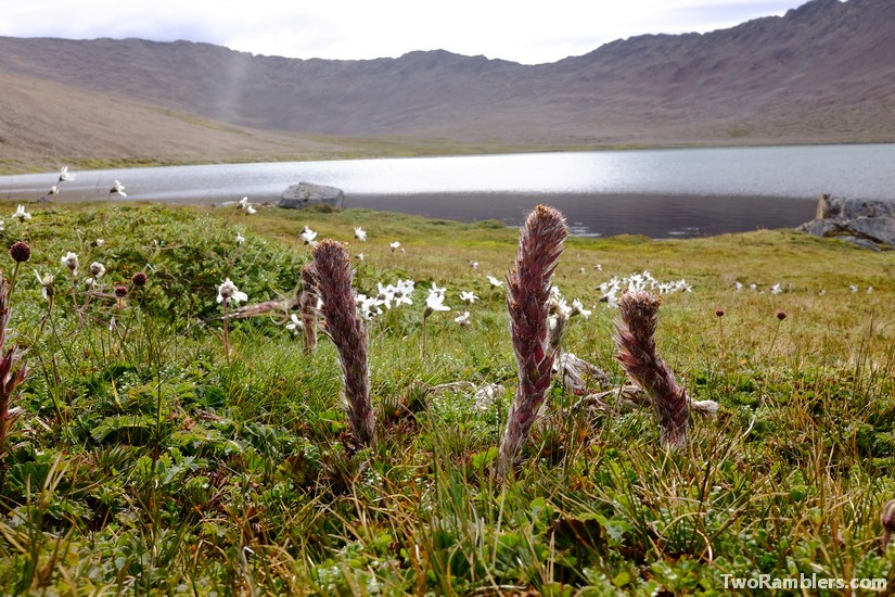
It was going to be a day of tough climbing to reach the Circuit. First we had to cross the long, seemingly endless swampy plain again. Then we walked into the forest and quickly started to climb upwards, in the direction of Monte Betinelli. It was difficult, the path was extremely steep. With a slow and steady pace we advanced and reached a flatter piece that let us out of the forest. Suddenly we found ourselves in a treeless, rocky landscape. Slowly continuing our way upwards we reached Laguna Betinelli in the shadow of Monte Betinelli. There we had lunch.
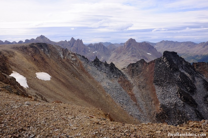
Some more steep climbing followed. It was not easy to find grip on the sandy and rocky ground. At the same time the Patagonian wind blew against us as if to keep us away from the top of Mount Betinelli. Finally at the mountain top we had a great view of what was lying ahead of us for the next day.
We made camp in a green, forestry valley, next to a small stream and enjoyed being on our own again.
Day 5: On the Dientes Circuit
We had some stormy weather at night but our tent protected us well. The morning brought a clear sky and the sun helped us dry our tent. We walked trough a small valley west of Mount Betinelli and finally reached the Dientes Circuit. There was a lot more waymarking, the route followed numbered posts. With the help of a brochure we had gotten in Punta Arenas we could now estimate a bit better what was lying ahead of us.
The route went in slopes, passed many lagoons, under our feet mostly sand and stones. The brochure had warned us about strong winds when climbing Paso Ventarron. Indeed, we had to watch out not to be blown off the edge of the small path by the sudden, strong blows. The loose stones did not provide a lot of grip and there was nothing around us to hold on to.
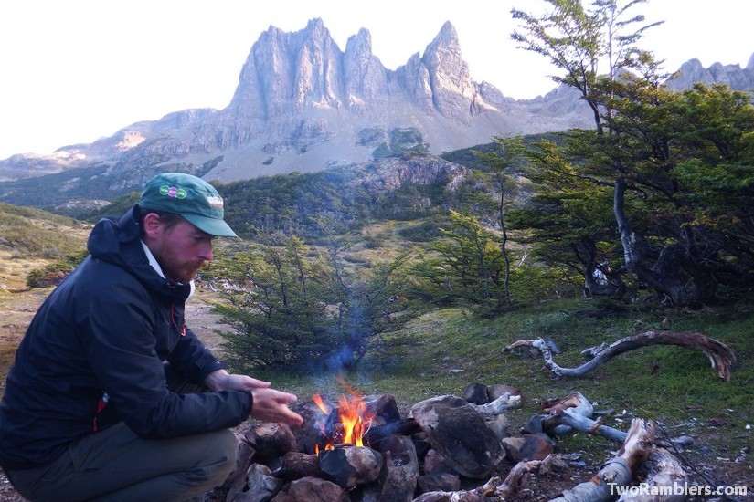
The rest of the day continued around some lagoons until we found a nice camping spot, a little hidden in the trees with a view on a tooth of the Dientes de Navarino.
Day 6: A long last day
Although we did not expect to have a long day in front of us, we started early. We had gotten used to our morning routine of making breakfast and packing up our tent. In the distance we could see what was lying ahead of us: the highest point of the hike, Paso Virginia at 800m.
We first walked, then climbed on a muddy path, going upwards steeper and steeper. We had to use our hands a lot to pull us up the slippery slope. Then the path became dry and rocky. We walked for probably an hour over slightly rising field of rubble. It resembled more a moon landscape than anything we had seen so far on the island.
On top of the Paso Virginia with a stunning view of the Laguna de los Guanacos, we could see what lay ahead of us: an extremely steep way downwards over more loose stones and sand. It was quite intimidating.
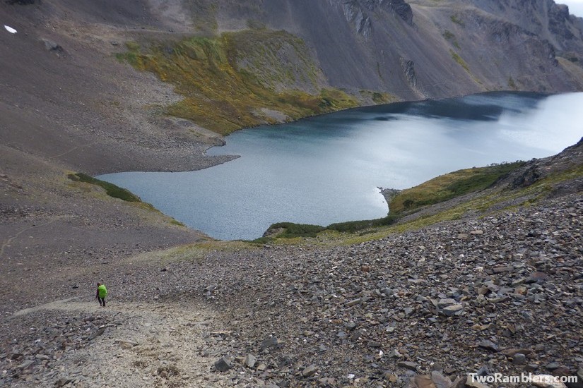
The first 20 meters were the hardest. The way – if it can be called a way – led almost straight downward with no grip to be found between the small stones. Kevin had to crawl a few meters when he lost trust in his shoes to hold him. Then to our surprise it did become fun. Sinking deep into the sandy ground with our feet we could slide forward. It was almost like skiing. Still we felt relieved when we reached the lagoon.
We had planned to camp after the lagoon but it was still rather early in the day and with some cold weather coming up we decided to keep moving. Under a slight rain that turned into hail at some point we continued, walking towards the end of the Dientes Circuit faster than we had planned. Unable to find a good camping spot we reached the last post. From there it was still a difficult route through some thorny bushes on paths full of cow pats.
As soon as we reached the road to Puerto Williams a car passed. Testing our luck we stuck out our thumb and got a ride back to town. We didn’t feel like checking into a hostel, instead we used the free campsite a little hidden at the Rio Ukika. With a bottle of wine and a campfire it was the perfect finale to our adventure.
Travel tips:
A good overview of the hikes on Isla Navarino and some context about the island’s history and ecology can be found on the site of the Chilean Ministry of National Heritage.
Information about the ferry to Puerto Williams can be found online. It leaves twice a week. Seats a limited, as a couple of them are reserved for the local population, so it makes sense to book in advance.


