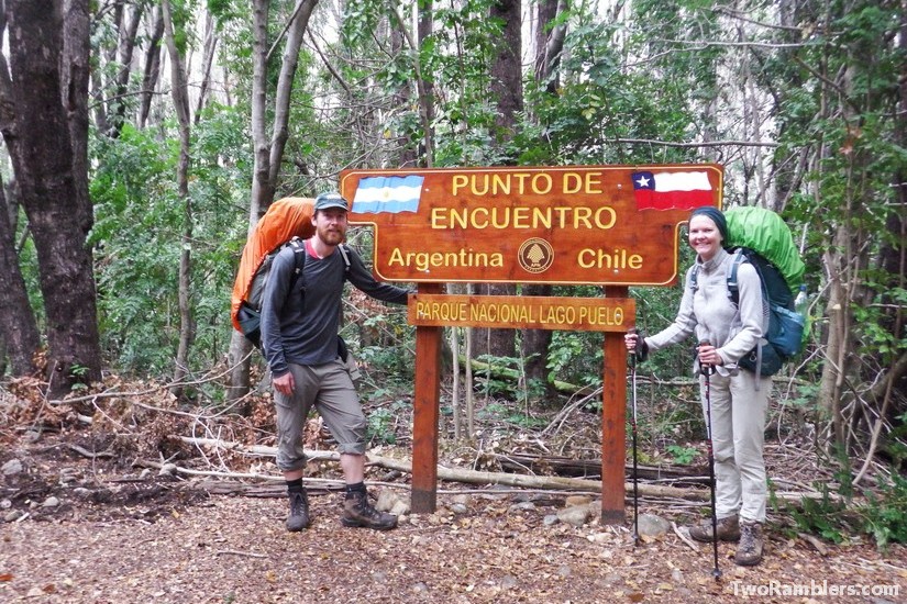
We had crossed the border between Argentina and Chile four times, by plane, bus and hitchhiking, when it was time to try something new: doing it on foot. Our plans to hike from El Chalten to O’Higgins had not worked out. First it had been too cold, then the timing of the ferry didn’t work out for us. When we discovered the border crossing point Paso Rio Puelo, just south of El Bolson we knew we had to do this.
Paso Rio Puelo is one of the border crossing points between Argentina and Chile that can only be accessed on foot or by crazy cyclists. There is no access for cars. It is also the lowest border crossing point in terms of altitude. This was great considering the snow we had encountered in the mountains of El Bolson.
Preparations for a heavy hike
Crossing the border on foot meant that for the first time during our trip we had to take all our things with us. Usually, we had left some of our stuff behind in a hostel. This was no option this time. We had no plans of going back to El Bolson afterwards. So we stuffed our 35 kg in our backpacks and made sure to wrap all our important papers and the computer in enough plastic bags to avoid any damage from rain.
Gathering information about the hike ahead of us wasn’t exactly easy. Information online was limited. We got a general idea that we first had to reach the Argentinian border police and from there it would be a day’s hike to the Chilean border guards. We should be able to reach a small village from there but it was not clear to us how long it would take to reach the next town and how we would continue our trip from there. The mountaineering office in El Bolson gave us the impression that it would be possible to do the hike despite winter being close. We also got the recommendation to rather take a boat over Lago Puelo directly to the Argentinian border guards. But we disregarded this because of the costs.
We spent our last day in El Bolson carefully using our last Argentinian Pesos for food for a hike of unknown duration. At the same time, we tried to limit the additional weight as much as possible. It required some calculations but we managed. From El Bolson we took a bus to the village Lago Puelo. The bus ride was an experience in itself. First, we met an enthusiastic, elderly couple wearing matching caps. They started talking to us. Then he started to sing Italian ballads for us, or maybe for the entire bus. He only stopped when a guy with a guitar got on the bus. Like the street musicians you could meet on the metro in Europe he sang songs and went around to collect money. His songs told about the lovely live in Argentina.
In Lago Puelo we tried to get more information about our hike from the tourist office but without success. They sent us to the local mountaineering office situated at the starting point of the hike. The village lies at the Rio Azul, the only bridge to cross the river, to start the hike to Chile is in the north of the village. It was quite a walk from the centre to reach the bridge. The mountaineering office was closed but we found a good camping spot in a park on the other river bank. With the money saved for a hostel we treated ourselves to a delicious brownie in Lago Puelo and then a taxi ride with our big backpacks back to the camping spot.
Day 1 – to the Argentinian border guards
The next morning, Kevin checked again with the mountaineering office. It was open but didn’t give us more information than we already knew. We were still unsure how our hike would look like once we reached Chile. After picking some walnuts from a big tree near our tent we started our adventure.
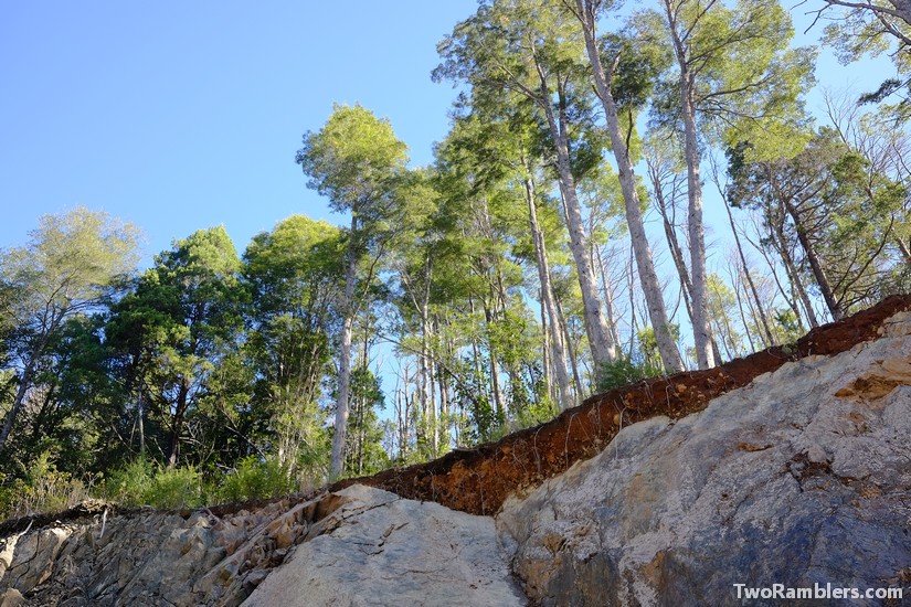
The first part of the hike felt like walking through someone’s garden. We walked over green grass, now end then crossed a fence, fruit trees all around us. The route went uphill with more trees around us on a sandy road through the forest. Along the road stood thick bushes of blackberries and rose hips. With our heavy backpacks and with a very sunny day we had to take many breaks. It was a good excuse to taste some of the berries but they were not very tasty. Despite the many breaks we made good progress and realised that the route wasn’t as long as we first had worried.
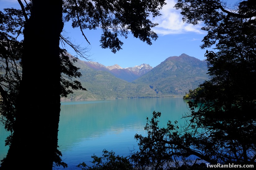
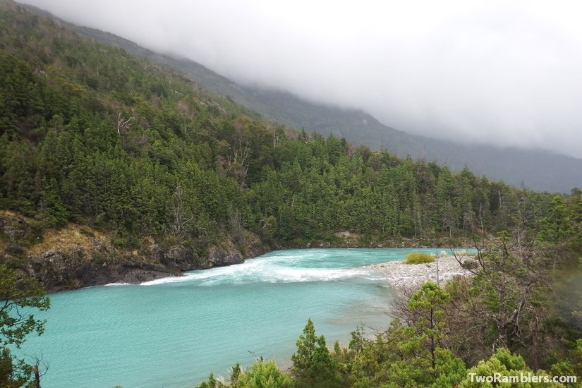
At about 3 pm we reached the Argentinian border guards. We were overwhelmed by a smell of fresh cooked jam in the air and started dreaming of some delicious desert. The guards didn’t offer us any food but there was a campsite right beside the ‘guarderia’ where we could stay for free. An Argentinian couple was already there. It was a beautiful spot at the lake Lago Puelo with its turquoise waters.
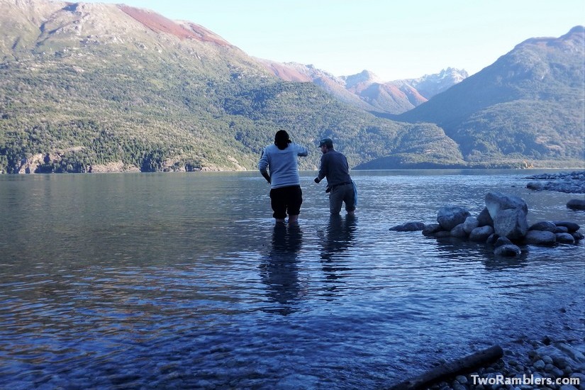
Although we were not officially allowed we tested our fishing luck. At the mouth of a stream into the lake we threw out our string and hook. At the beach we found a can and string, someone else’s fishing line. It was tangled around a stone in the water. Kevin was curious to know what happened to the line and hoped to find a good hook on it. He traced the line into the lake and pulled at it to get it off the rock. Suddenly, the line started to move. Kevin pulled a bit more and found a trout at the end of the line. We had no luck with our own line afterwards but at least had a big fish to share with the other campers as a starter.
Day 2 – via Los Hitos to the Chilean border guards
The night was unusually warm and as we woke up the air felt like a storm was about to hit us. We got our stamps from the border guards to exit the country and some information about the forecast predicting rain. Then we went our way. Our first aim was to reach Los Hitos, the border point between Argentina and Chile.
It took us about two hours to get there. At Los Hitos we had a to cross a bridge over another wild river. On the other side, two young Chilean border guards were out on a stroll. They asked for our passports and took a photo of us with their phone. It seemed like we were an attraction crossing the border on foot this close to winter.
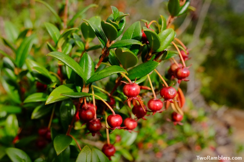
The guards escorted us for a moment, one walking in front, one behind us. They quickly realised that with our heavy backpacks we couldn’t keep up with their speed. Just before they left us behind we saw one of them eating some red and pink berries that we had seen in the bushes around us the entire day. As we picked some of them we realised that the strong smell of fresh jam the day before must have come from these berries. And not only the smell was delicious. They tasted like a mix of strawberries with a hint of basil and something else, maybe kiwi. For the rest of the day we couldn’t stop eating them.
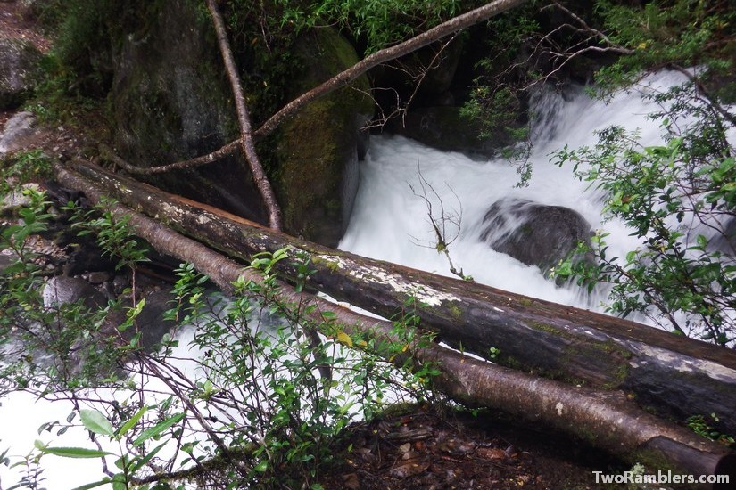
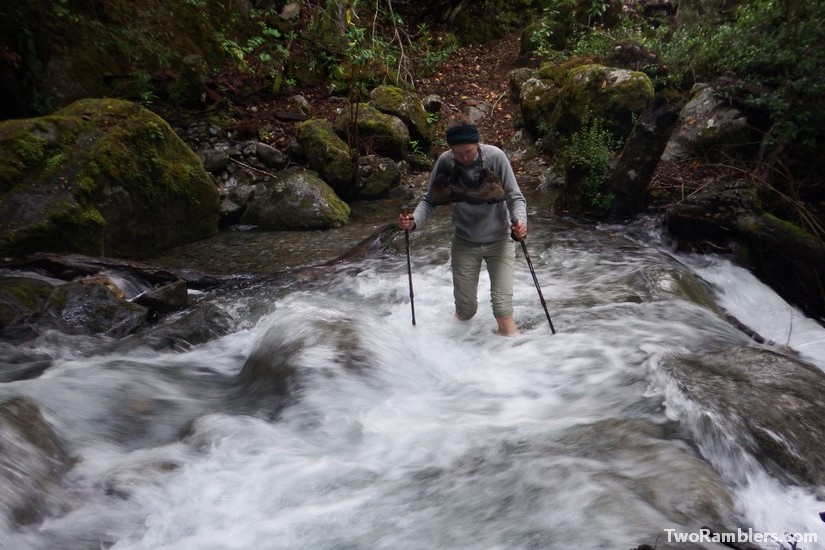
The rain had started as soon as we had left the camp site but it wasn’t strong and didn’t reach us through the thick forest around us. Anyway, we got wet enough crossing several rivers with very wild waters. Sometimes there was only a slippery, moving trunk that served as a bridge. Once there was nothing and we had to get our shoes and socks off to get into the icy water and cross to the other side. Later the Chilean border guards told us that the rivers and streams were particularly high that afternoon due to the rain.
After a long walk we finally reached the Chilean border guards. It took them a while to check our passports and Kevin had to empty his entire backpack to be searched. We had hoped to receive some more information about where to continue our hike but the guards discouraged us. They said that at the end of the season the hiking tracks were no longer well maintained. Instead, they ordered a ferry for us to bring us to Segundo Corral, a village on the other side of Lago Inferior. From there we would be able to walk to Primer Corral and catch a bus to bigger towns. Before we were able to make up our mind if we still wanted to push through with hiking all the way, they ushered us to the lake to take the ferry.
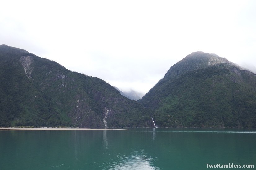
The boat ride offered some nice views on the blue water and the dark green pine tress all around. From the landing point of the ferry, we walked another half hour into the village. We considered camping out in the forests but felt the cold after the rainy day. So we were happy to find a campsite with a refuge in Segundo Corral. We could sleep inside the basic refuge and light a fire to warm up.
Day 3 – to Primer Corral
The next morning we decided to avoid hiking much further with our full backpacks. The Chilean border guards had given us a good map with hikes in the area and we found a nice route starting in Cochamo. To get there we had to walk to Primer Corral and take a bus from there, then a ferry and another bus.
Before setting off, we hoped to buy some bread in the village. Our host had explained us the way to a shop. We had to walk through the forest to find another street also belonging to Segundo Corral. There was an old, run down school building, several wooden houses, all locked up and a small hospital. The only person we met was a nurse but she didn’t know of any open store. So we stuck to collecting a few more walnuts and then continued our hike.
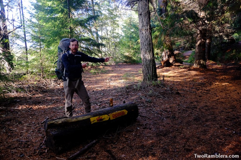
The walk let us first along some fields and then over a sandy road. The road led straight over some mountains where big machines were being used to dig out the road. It was a road under construction. The first one to lead to the small border village of Segundo Corral. It took us about three hours to get to Primer Corral. This was much faster than indicated on the map on our phone from maps.me. The app wasn’t aware of the new route yet. While there was less pure nature around us than the previous days, it was a lot easier to walk on the newly constructed road. And it was actually really impressive to see how the military was digging this new road straight through the mountains.
Primer Corral was mainly a military base. We tried to hitchhike from there but had not luck. There were few cars passing and most of them stopped at the military base. In the end, we found a campsite at a lake. Kevin went fishing in the evening sun, while Franziska put up the tent and cooked some pasta. There was nobody else around. We sat at a warming fire under a sky full of stars and enjoyed the last night of this heavy hike.
The next morning, we took a bus that brought us to the ferry over Lago Tagua Tagua. On the ferry, we found a guy with a pick up truck who was able to give us a lift to Cochamo. So we didn’t have to pay for the second bus. It was a beautiful road along Estero Reloncavi, an arm of the Pacific Ocean going far into the mainland, we were driving through the Chilean fjords.
Once we reached Cochamo we realised that the hiking season in the area was done. The weather forecast predicted temperatures of -8 °C for the next days. So we decided to head further north towards the Chilean lake region. However, we felt like we had wisely spent the last days of warm weather on the hike over the border. We had been on a very isolated route, proven to ourselves that we could hike with our heavy backpacks and discovered the ‘murtilla’ berries (also known as Chilean guava) – probably the most delicious berries in the world!


Hey Guys,
Great storytelling! I’m going to be travelling by bicycle through this part of Argentina-chile in about a month. Wondered if you think it is crazy for a cyclist to be out on these tracks. That photo of the slippery log crossing looks like it would be interesting on foot let alone with a bike. Did you come across anyone who would be willing to do the entire boat ride from Lago Puelo (town) to Segundo Corral? Or was it your experience that they would drop you at the border?
Cheers and happy adventuring
Georgia
Hi Georgia, thanks a lot for your comment. Sounds like a great plan to cycle in Argentina and Chile! We didn’t meet anybody else on the route across the border, especially not by bike. But we found a few blogs of people who did the route by bike. It seems possible but maybe not so much fun. Some of the streams you can just cross straight through the water with your bike but there is one where you probably have to use that log ‘bridge’.
I don’t think there is any boats connecting Lago Puelo to Lago Inferior but we were not looking for them either.
Take a look at these blogs for cycling the route: http://spokeandwords.com/battling-brush-funky-border-crossing-back/ and https://keppler.me/2015/11/20/route-notes-paso-rio-puelo-chile-argentinia-via-segundo-corral-el-bolson/.
All the best for your trip!
I recently cycled this trail (actually I had to push and carry the bike) and I have documented my experience at my blog. I would not recommend trying to hike the trail unless you are a bikepacker with almost no gear, and you have a lot of upper body strength. However, if you are willing to pay for the boat to take you all the way to the Argentinian side, this is a very beautiful and interesting part of Chile.
Hi, C. Golembiewski. Hiking it by foot is possible, as we did it, but doing it with bike can be very dangerous on those slippery logs when crossing the rivers. But it can be done as there are some nice stories to find online from adventures who did it, but at your own risk ofcourse. But the region is indeed very beautiful and one of my favourits.